Bienvenue sur Business Wire

BUSINESS WIRE

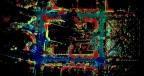
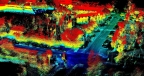
Équipé de capteurs lidar de Velodyne, l’Eagle X de Techmake atterrit sur le marché de la cartographie aérienne
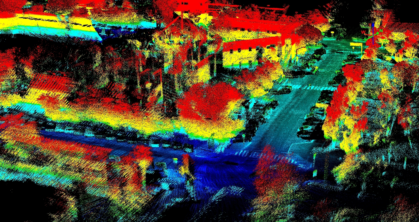
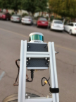
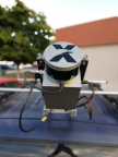
Techmake Solutions relies on Velodyne’s rich computer perception data in its Eagle X mapping and surveying system. (Photo: Business Wire)